
Walk a Downers Grove Street
A useful street-by-street search joins records in a fixed order. Begin with one valid address instead of a broad name search. The parcel record establishes the situs, meaning the physical location, while the deed index records named parties to an instrument. A voter result or permit can add a dated connection. It cannot turn an owner list into a household list.
- Enter the house number and street in the DuPage Assessor address search. Save the situs address, PIN, owner or billing name, legal description, and tax year.
- Open the same location in the County Parcel Viewer. Follow parcel lines along the street and note splits, common land, or lots with another street frontage.
- Check the DuPage voter address mode for one address when election geography is relevant. Keep the precinct and lookup date, and do not treat it as a street-wide roster.
- Carry the PIN, owner name, and legal description into the Recorder search. Follow the newest deed to its grantor and record each party role.
- Use Village permits, service records, maps, and local directories only for the time period they cover. Verify each clue at its own custodian.
This order keeps unlike facts apart. A bill recipient may live elsewhere. A deed names parties at recording time. A permit applicant may be a contractor. When the goal becomes older occupancy rather than today’s street, the Downers Grove previous-residents trail carries the address backward.
Downers Grove Address Search Fields
The DuPage property address search is the strongest first stop for a current parcel. Its related modes accept a PIN, billing name, or map selection. Use the portal’s separate direction and city controls where shown. Do not force a directional letter into the street-name field.
| Search control | Input | Street-directory use |
|---|---|---|
| Address mode | Street number, name, city | Find the parcel tied to the typed situs. |
| PIN mode | Segmented parcel identifier | Bridge spelling changes and parcel records. |
| Billing name | Person, trust, or entity | Find tax-mail records, not assured occupancy. |
| Map mode | Map selection | Inspect lots along the same street segment. |
| GIS advanced | PIN, number, direction, name, apartment, city, ZIP | Join address fields to parcel geometry. |
| GIS buffer | Distance, units, polygon or center point | Select nearby parcels for careful review. |
The assessor’s datalet may expose current and past assessed values, transfers, conveyances, exemptions, appeals, legal and map tabs, and split or combine information. It reflects the last certified assessment and carries no warranty. Record the tax year rather than presenting the result as live proof of who lives there.
See the official address-search screen captured for Downers Grove:
The screen shows the address-led route that turns a street line into a parcel result before any owner or deed claim is made.
Downers Grove Parcel Terms
A street directory becomes much easier once four record terms stay distinct. They prevent a mailing location, map shape, or historical index from being mistaken for a current resident address.
- Parcel
- A mapped tract of land identified for assessment. One street address can involve more than one parcel, and one parcel can change after a split or combination.
- Situs address
- The physical location assigned to the parcel. It is not the same as the owner or billing address.
- Plat
- A recorded map that sets out lots, blocks, subdivisions, dedications, or vacations. It helps translate a street line into legal land language.
- Criss-cross directory
- A directory arranged by address or telephone number rather than only by surname. It supplies a dated occupant clue, not proof of current occupancy.
One inspected county layer paired a Downers Grove situs with a Riverwoods billing location. That local example is why the Downers Grove street directory should preserve both labels exactly. The billing field tells where a notice went, while the situs field identifies the land.
The separate DuPage PIN search source is shown here:
PIN search is the stable handoff when an address spelling, postal city, or old directory entry no longer lines up with the current street string.
Map Downers Grove Street Parcels
The Village Map Services page adds address points, parcels, street names, Village limits, zoning, planned developments, land use, aerial views, school districts, historic resources, and Downers Grove Foursquares. The County viewer adds parcel selection, subdivision and shape searches, Pictometry, measurement, street intersections, and a buffer tool. Map layers answer different questions, so note the source and layer date.
For a whole road, locate a known parcel, pan along the segment, and select each polygon in turn. Alleys, railroad rights-of-way, park strips, common areas, and corner lots can make the nearest label misleading. Confirm each candidate PIN in the assessor record. A visual line on a map is not enough to identify an owner, an occupant, or a legal boundary.
The Downers Grove map-service capture shows the local entry point:
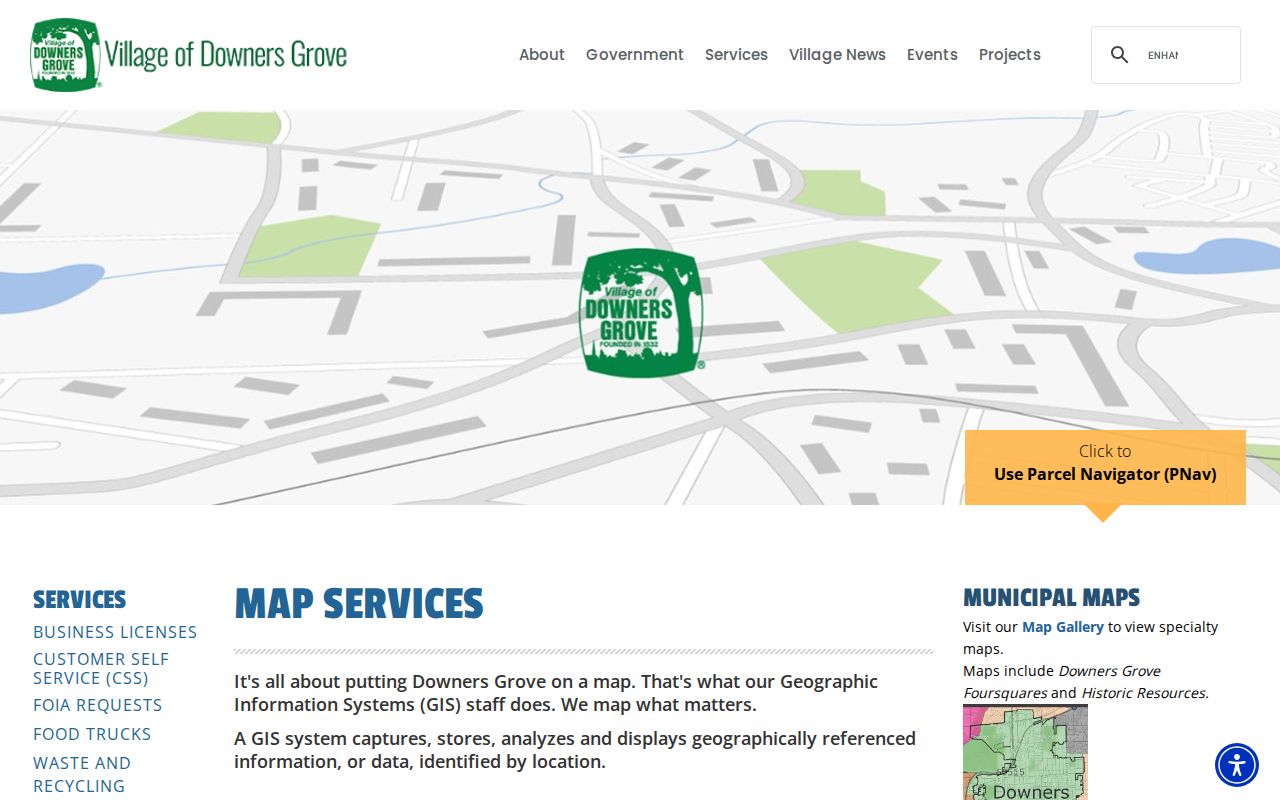
These Village layers give the street directory local-limit and historic context that a county tax card alone does not supply.
Note: County and Village maps can update on different dates, so save the layer name and inspection date with every parcel note.
Downers Grove Records by Street
No single Downers Grove street directory contains every person or event tied to a road. The strongest result is a sourced set of address-keyed records. Online portals provide the first pass, while office terminals, counters, phone help, FOIA, and library research cover missing images or older years.
| Address record | Custodian | Useful result | Access route |
|---|---|---|---|
| Assessment card | DuPage Assessor | PIN, situs, owner or billing name, values, legal and history tabs | Online, map, phone, counter |
| Parcel geometry | County and Village GIS | Boundaries, address points, layers, districts | Viewer, REST layer, map request |
| Recorded instruments | DuPage Recorder | Parties, date, type, PIN, legal description, image | Index, public terminal, research desk, copies |
| Tax history | County Collector | Tax years, bills, payments, value-change clues | Collector Books and office |
| Election geography | DuPage Elections | Status, precinct, polling map, districts for an address | One-address lookup and lawful request |
| Permit or service event | Village or County Accela | Project, inspection, location, record date, status | Portal, account, counter, FOIA |
A street address moves cleanly through this table only when the PIN and situs match. If an image is absent, call the Recorder research desk at 630-407-5401 or use public terminals at 421 N County Farm Road in Wheaton. The Assessor is at the same address, with phone 630-407-6500 and weekday hours of 8 a.m. to 4:30 p.m.
Deeds Along Downers Grove Streets
The DuPage Recorder search accepts name, property, and document paths. Property controls include street number, direction, street, city, and four PIN segments. The document side supports a number, type group, type, and start and end dates. Search deeds, quitclaim deeds, transfers on death, plats, easements, and related records according to the question.
Coverage is uneven, which is a key local fact. Computerized name indexing begins in 1961, PIN searching in 1985, property-address searching in 1995, and plats reach into the 1800s. Older books date to the county’s 1839 organization period, but the office research desk or terminal may be needed. An address with no pre-1995 online hit is not proof that no deed exists.
Build the chain as one short flow: street address → assessor PIN and legal description → latest deed → named grantor and grantee → prior deed. Keep entities, trusts, spouses, estates, and spelling variants exactly as indexed. A recorded instrument shows a transaction, not guaranteed present ownership.
Downers Grove Address Events
Permits and service requests add a dated event to the street directory. The Village permit system supports address search, applications, uploaded documents, comments, inspections, fees, and approved permit cards. The county Accela property and record lookup accepts an address, parcel, owner, or record information, with detailed street, unit, city, state, and ZIP fields.
The county address and parcel screen appears here:
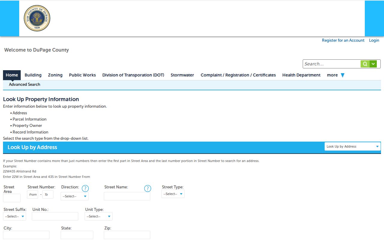
Its split address fields are useful when a county number includes a street area, direction, unit, or postal label that a simple search box misses.
A permit applicant may be an owner, agent, architect, or contractor. A complaint does not prove a violation. The Village says a service request may be anonymous and that a complainant’s name is confidential under its explanation. Treat the public location, description, status, and date as the usable facts.
The Village service-request source is captured below:
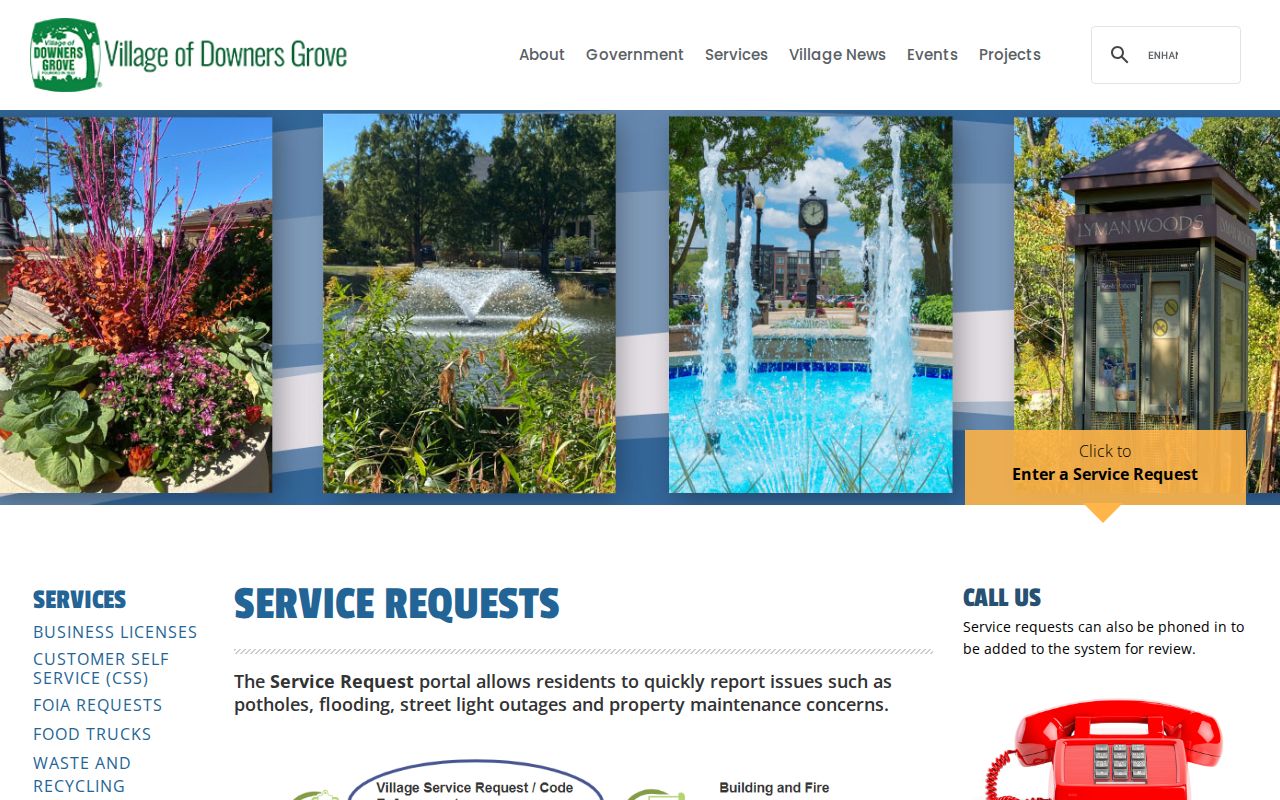
The location-led workflow can date a municipal event on a street without identifying everyone connected to the property.
Downers Grove Voter Address Limits
The DuPage voter lookup has Name, Address, and District modes. Address mode asks for house number, street name, direction, suffix, and city. A result can return registration status, precinct, polling place or map, sample ballot, and representatives. It is useful for one permitted address query, not for downloading every voter along a road.
Illinois Election Code section 4-8 permits inspection within stated limits while protecting Social Security, driver-license, and protected-voter address information. The public search does not expose a general street-roster button. A registration result can also change after a move or list maintenance, so date it and verify the right person with another official source.
Note: Property owners, bill recipients, registered voters, permit applicants, and people who sleep at an address are overlapping but different groups.
When Downers Grove Addresses Shift
Old street searches can fail for several sound reasons. A directory may use an obsolete abbreviation. A lot may have split or combined. A postal city can differ from the Village label, including the documented 60517 Woodridge and Downers Grove edge. The Recorder’s address index also stops at 1995 for online address searching.
There is no verified local street-renumbering chronology in the research. Do not assign a year from guesswork. Bridge a changed string with the PIN, legal description, subdivision plat, Village Historic Resources map, 1909, 1921, and 1927 Sanborn sheets, local newspaper notices, and the historical directory shelf. Downers Grove incorporated in 1873, while DuPage records moved from Naperville to Wheaton when Wheaton became county seat in 1867. Those dates explain repository geography, not an address renumbering.
Limits of Downers Grove Street Records
A parcel card can show an owner or billing name, not every resident. A voter lookup excludes people who are not registered and may protect an address. A deed is tied to an instrument date. Directory entries are historical snapshots. Utilities, private association rosters, and protected addresses do not become public merely because a street can be mapped.
Use a street directory for lawful family research, property curiosity, scam checks, and civic understanding. Confirm names with the office that created the record. Never publish protected identifiers or infer a private person’s physical location from a remote billing address.
Lawful use. Downers Grove address records must not be used to stalk, harass, threaten, or harm anyone. Respect confidentiality and redaction programs.