
Public Clues About Downers Grove Neighbors
No single source proves who occupies every place on a block. The useful records divide the question into parcel geometry, current indexed ownership, dated events, election geography, and public community activity.
| Source | What it shows around a block | Access route |
|---|---|---|
| DuPage Parcel Viewer | Parcel lines, PINs, situs and assessment fields, districts | Public map and ArcGIS layer |
| DuPage Property Lookup | Owner/billing name, situs, values, transfers, legal and map tabs | Online, map, phone, or counter |
| Recorder instruments | Plats, easements, deeds, dedications, vacations | Online index, public terminal, copies |
| Village and Accela records | Map layers, permits, inspections, dated site events | Public pages, account features, FOIA fallback |
| DuPage voter lookup | One-address election geography and registration-related result | Name, address, or district mode |
| Association pages | Public notices, events, documents, community contacts | Public page or request route |
An indexed owner may be a person, trust, company, or several parties. A billing address may be far from the parcel, and neither field establishes every resident. Record what a source actually calls the field.
Select the Subject Parcel for Downers Grove Neighbors
Begin with the exact address or PIN in the DuPage viewer. Search by PIN, property address, map selection, shape, or subdivision. Confirm the selected polygon against the situs address before looking outward. This prevents the map label for a nearby lot from becoming the assumed subject.
The DuPage assessment parcel layer exposes the map and field structure used for this work.
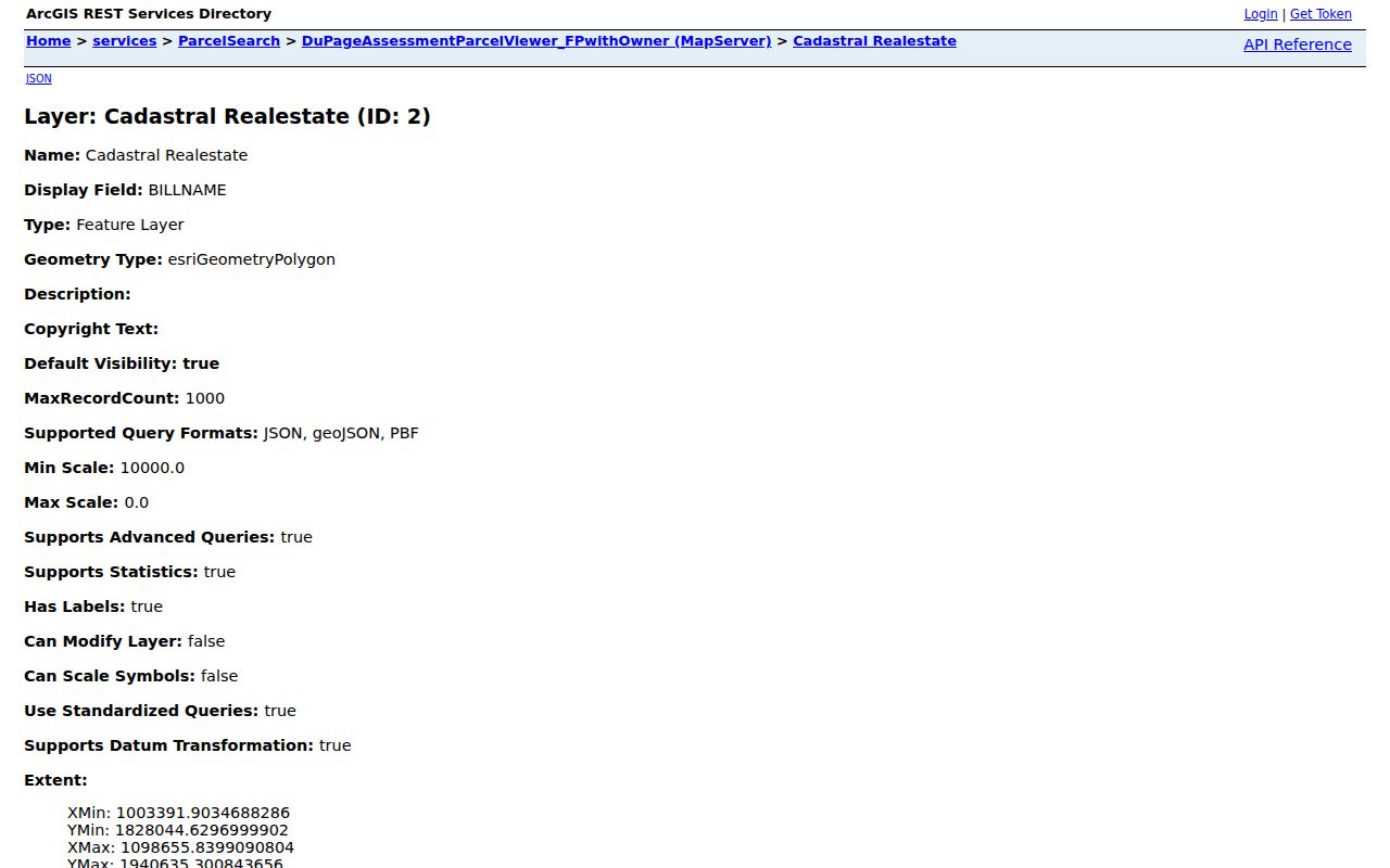
The layer can return PIN, acreage, multiple-PIN status, owner and billing fields, situs components, parcel status, basin, and class. Treat its geometry as the adjacency clue and verify readable facts in the Assessor card.
Build a Downers Grove Neighbor Buffer
The viewer help distinguishes polygon and center-point buffers. That matters because the same distance can select different candidates. For legal adjacency, start with parcel polygons and inspect shared edges. For a broader radius, state the distance and method used.
- Search the subject address or PIN and confirm its polygon.
- Turn on parcel and street-name layers.
- Enter the buffer distance and units.
- Run Select By Buffer and save the candidate PINs.
- Open each candidate in the Assessor rather than trusting a map label.
- Clear the buffer before testing another method.
The result is a candidate set of surrounding parcels. It is not a list of Downers Grove neighbors. For the longer chain along an entire named road, use the Downers Grove street directory.
Confirm Each Downers Grove Neighbor Parcel
The public property card is the second pass. It can show PIN, neighborhood, roll, owner or billing name, situs, tax year, tax entities, assessed values, transfer or conveyance data, exemptions, appeals, split or combine history, legal description, and maps.
The sample DuPage parcel card demonstrates how those fields are grouped.
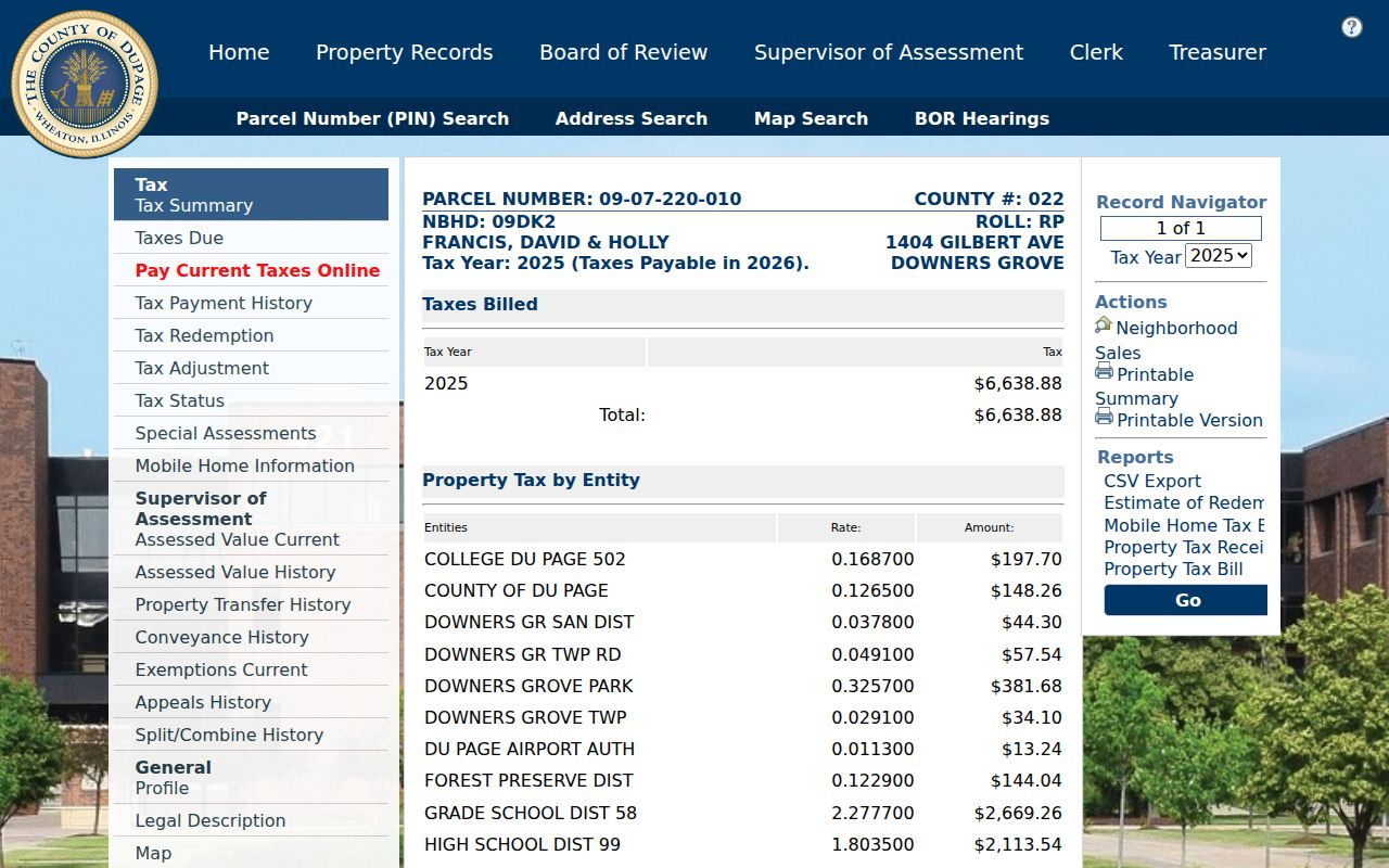
The inspected sample identifies PIN 09-07-220-010 and a Gilbert Avenue situs, along with a named owner/billing field and tax history. It is a useful field inventory, not a template for claiming that all named parties occupy the site.
Fields that should not be merged
Situs: the parcel's physical location. Billing address: where notices go. PIN: the parcel identifier. Owner field: the indexed ownership label. Occupant: a person living there, which these fields may not establish.
Legal Edges Around a Downers Grove Block
A parcel that looks close on an aerial image may not share a legal boundary. An alley, common area, railroad right-of-way, park strip, or condominium parcel can stand between two lots. Map labels can also sit away from the parcel they describe.
Use Recorder plats, easements, dedications, vacations, and subdivision instruments to explain an uncertain edge. A split or combination can create more than one PIN, so compare the Assessor profile and split/combine tabs with the recorded legal description. The correct neighbor candidate is the parcel supported by geometry and record identity, not the closest printed number.
Layer Local Context Around Downers Grove Neighbors
Village Map Services adds address points, parcels, street names, Village limits, zoning, planned developments, land use, trees, downtown parking, agreement boundaries, contours, aerial imagery, and school districts. It also offers Historic Resources and Downers Grove Foursquares maps. County layers add assessment, precinct, polling, parcel, aerial, and Pictometry views.
Each layer has its own purpose and update cycle. Save the layer name and inspection date. A zoning polygon does not identify an occupant, and an election precinct does not establish ownership. The value comes from seeing how one block participates in several civic systems without blending those systems into a false resident directory.
Read Dated Events on a Downers Grove Block
Village permits and DuPage Accela can add a dated site event. Search controls include address, parcel, record number, project, record type, date range, contractor or contact, city, state, and ZIP. Permit and inspection records can help date work, yet they do not prove who currently lives at the property.
The Village permit and inspection portal is one official access channel.
The portal capture shows the account entry point. When a public item is not exposed there, use the Village counter or a narrow Illinois Freedom of Information Act request rather than assuming no file exists.
Public Community Pages for Downers Grove Neighbors
Association pages add notices and civic context, not a guaranteed household roster. The Downers Grove research found two named community sites and a sanitary-district packet that inventories more groups in its service area.
| Community source | Public material found | Access note |
|---|---|---|
| Brookeridge Homeowners Association | Downers Grove 60516 news, events, community material | No public member roster found |
| Liberty Park Community | Newsletters, text alerts, document-request route | Requests may take 7 to 10 business days |
| Sanitary District board packet | Names Fairview, Innisbrook, Kensington Place, Liberty Park, Orchard Brook, Victoria Ridge, and others | An inventory, not proof of a public directory |
| Village community directory | Downtown Management and Chamber630 links | No block-by-block resident list |
The Brookeridge public community page appears in the successful image set.
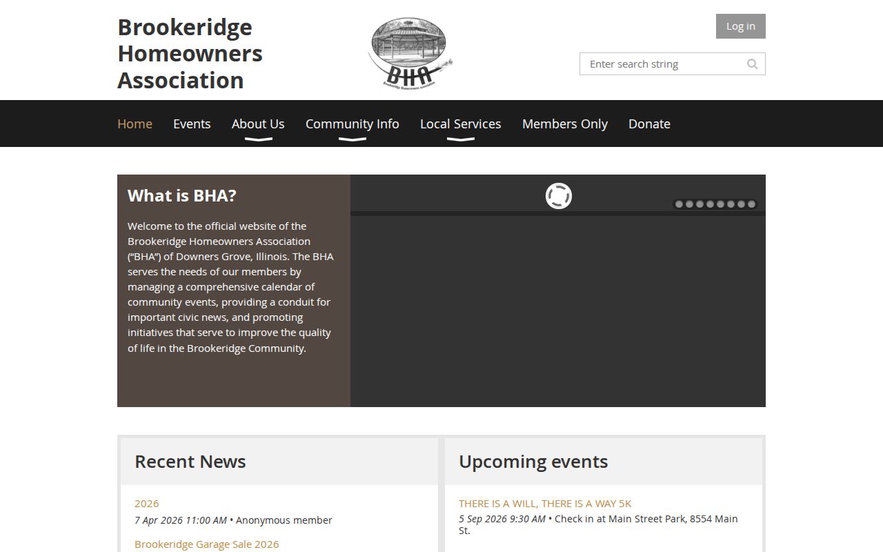
The image supports the public community layer. Private rosters remain unavailable unless the association itself chooses to release them.
Voter Geography Is Not a List of Downers Grove Neighbors
The DuPage voter tool has Name, Address, and District modes. An address query takes house number, street name, direction, suffix, and city. It may return precinct, map, representatives, polling information, or a registration-related status for the query.
It does not offer a public command for every voter on a block. Illinois Election Code section 4-8 protects Social Security and driver's-license data, limits protected-voter addresses, and governs inspection and use. A property owner is not automatically a voter, a voter is not automatically an owner, and neither fact proves current occupancy.
Tax History Adds Time, Not Occupancy
County Collector Books can show tax years and changes that help place a parcel event in time. Compare that record with the Assessor History, Property Transfer, Conveyance, Exemptions, and Appeals tabs. A value jump can suggest an improvement that deserves a permit check, but it does not name each person tied to the work.
The DuPage Collector Books portal was captured for this page.
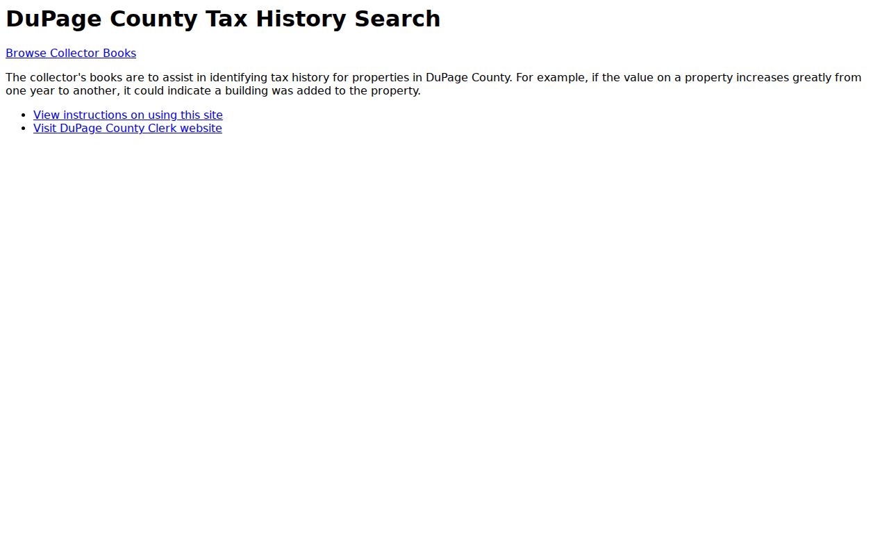
The historical tax route rounds out the block record by adding dates, while the parcel and Recorder sources remain responsible for ownership and legal identity.
Official Records and Commercial Neighbor Tools
Official sources are narrower but disclose their custodian, field names, and purpose. County GIS maps parcels. The Assessor publishes assessment fields. The Recorder indexes instruments. Elections provides a controlled civic lookup. Association pages publish what their groups choose to make public.
Official rolls
Known custodian, dated fields, defined corrections, public-terminal or request fallback, and clear limits.
Commercial category
May merge old addresses, names, phones, and unrelated people without showing the source date or match method.
For Downers Grove neighbors, preserve the official link and lookup date. Treat every commercial match as an unverified lead and correct an error at the source that created it.
Privacy Boundaries for Downers Grove Neighbors
Illinois' Address Confidentiality Program gives eligible survivors a substitute address and mail forwarding. Agencies must accept that address for new public records within program scope, while older records may remain and real-property files can be difficult to shield. Voter participants follow the program's protected application and vote-by-mail route.
Illinois FOIA section 7 also permits redaction of exempt private information. Court, voter, vital, Recorder, and other custodians apply their own statutes. A missing physical address may therefore reflect lawful protection, not bad data. Never reconstruct a hidden field from several public fragments.
Lawful use. Use block records for civic curiosity, property research, or respectful contact, never to watch, frighten, threaten, or harass a person.